
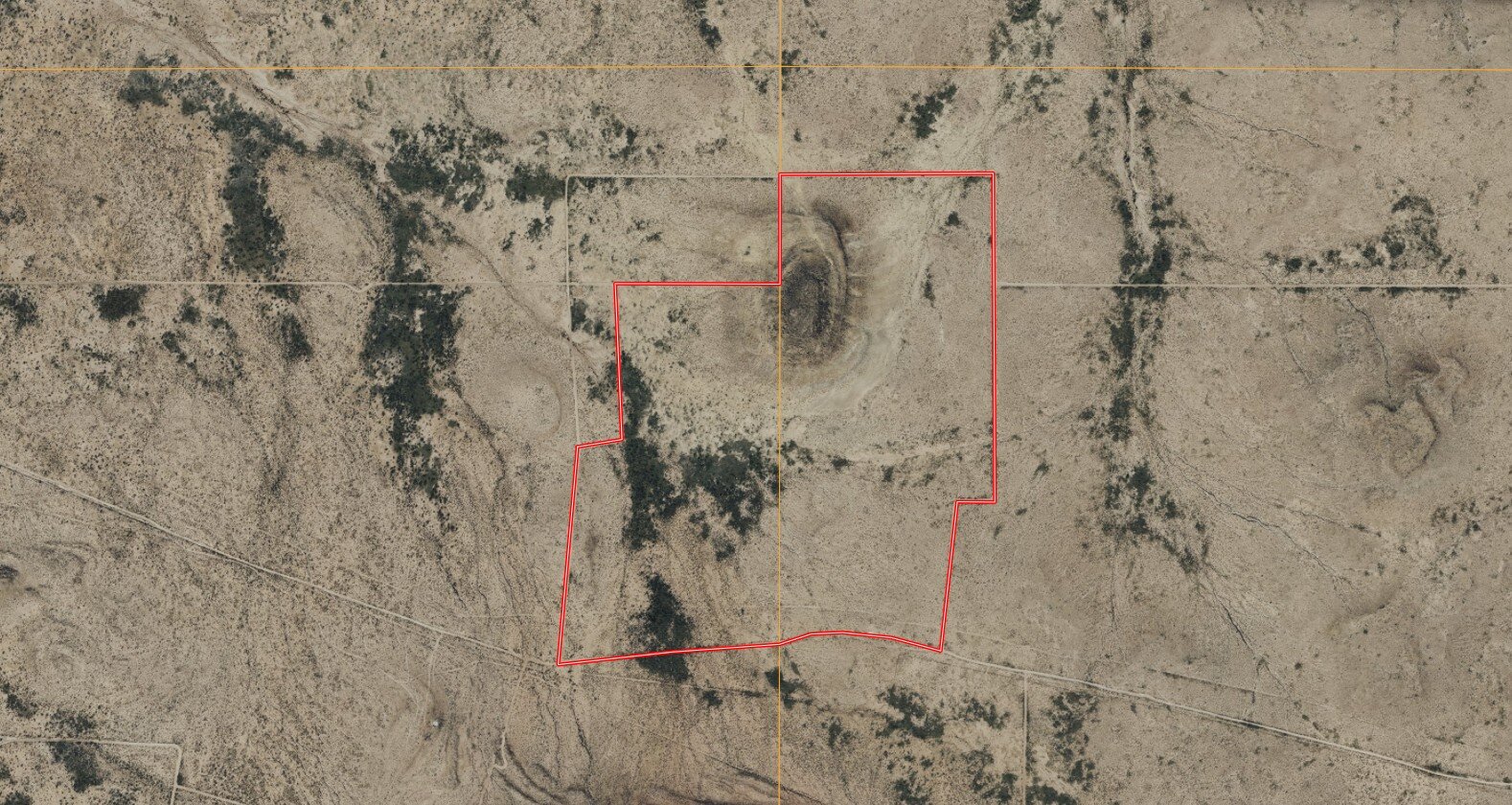
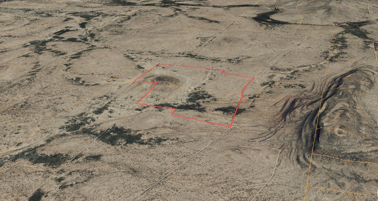
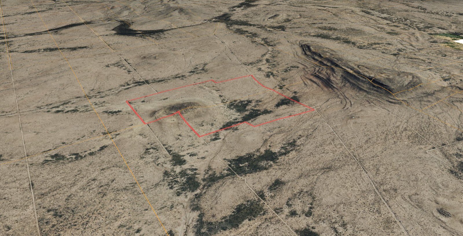
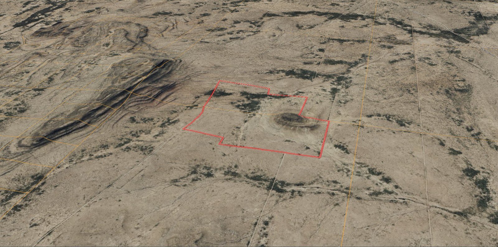
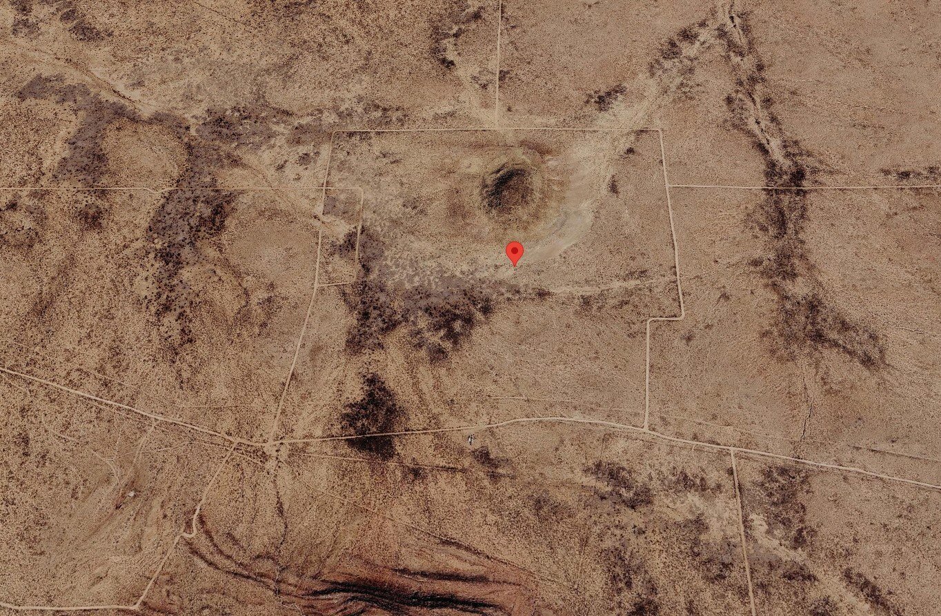
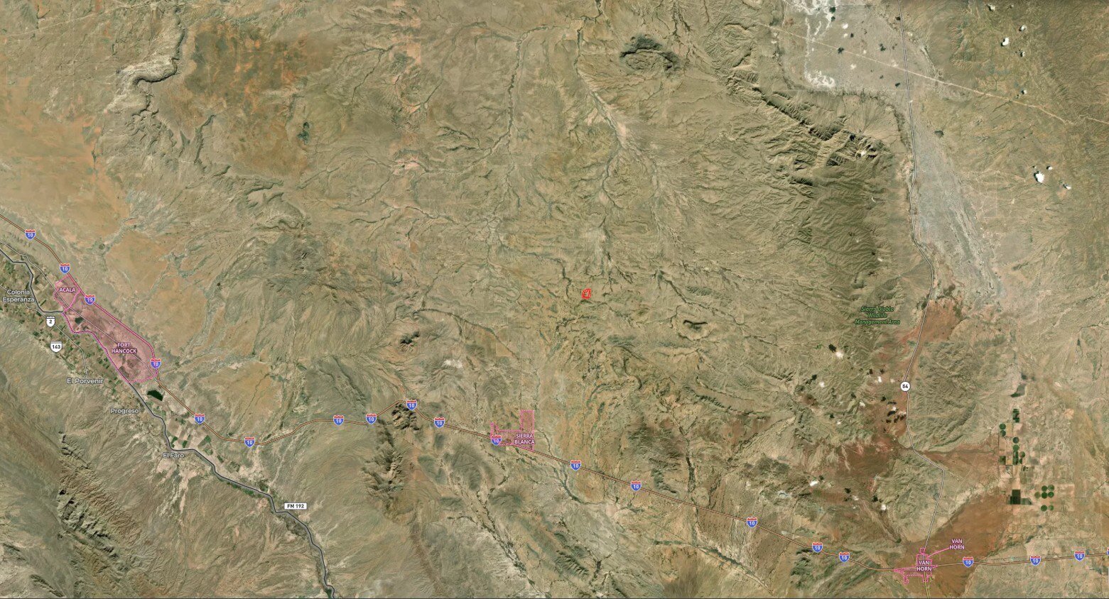
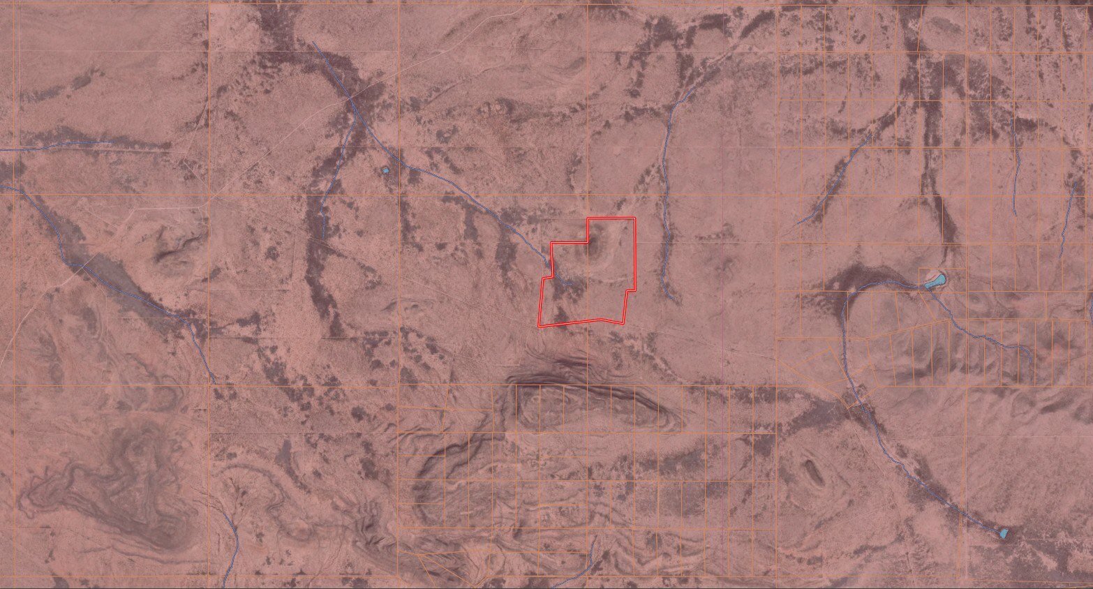
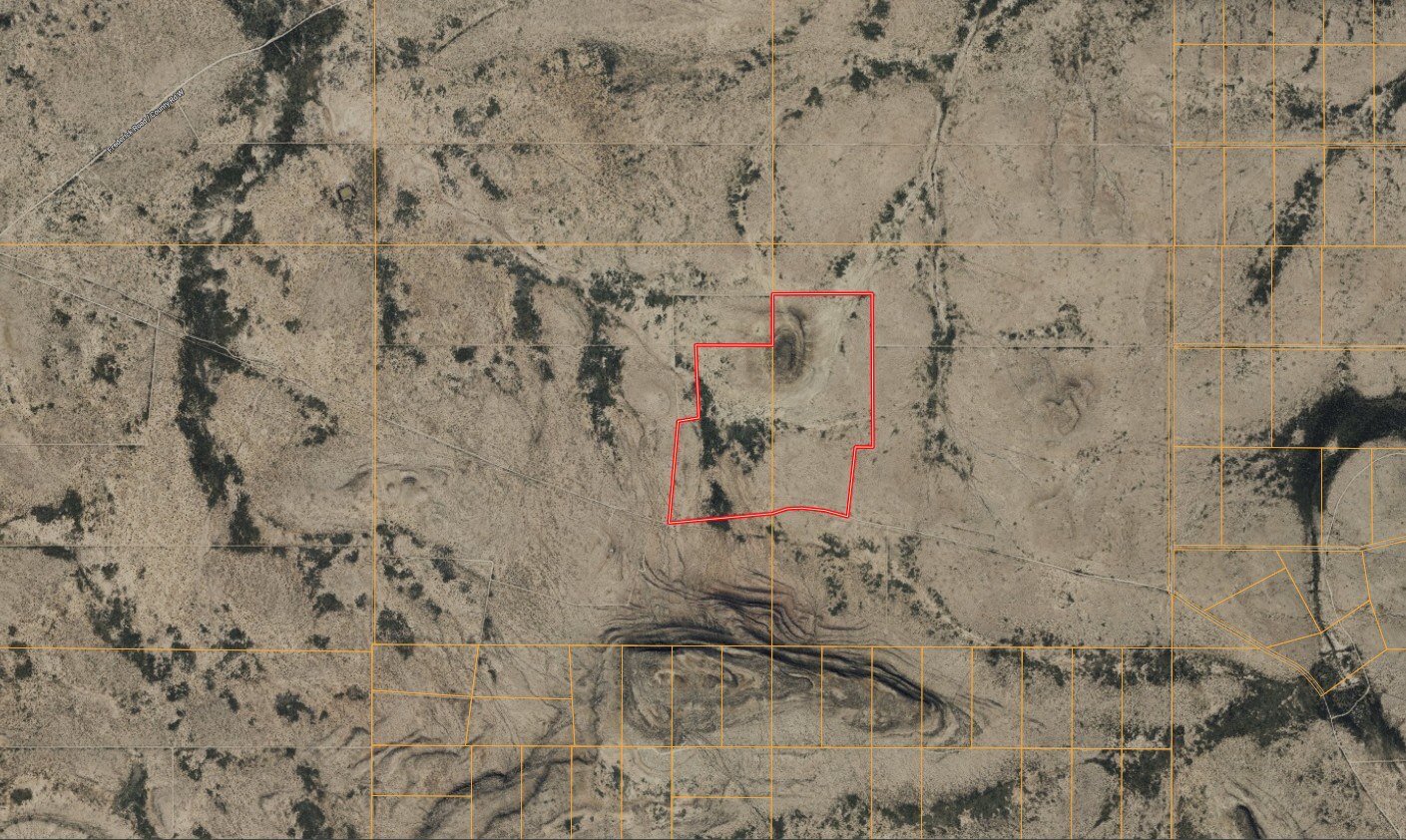
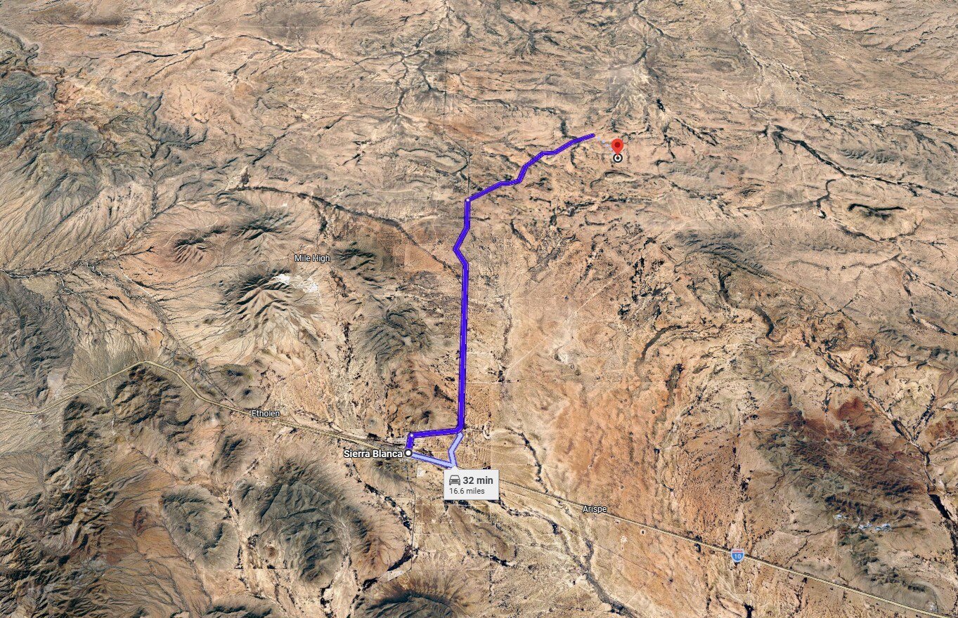
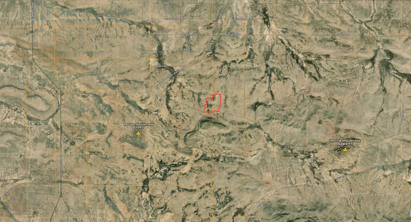
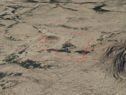
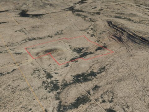
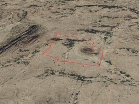
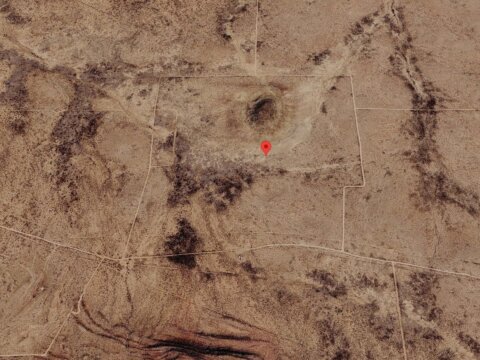
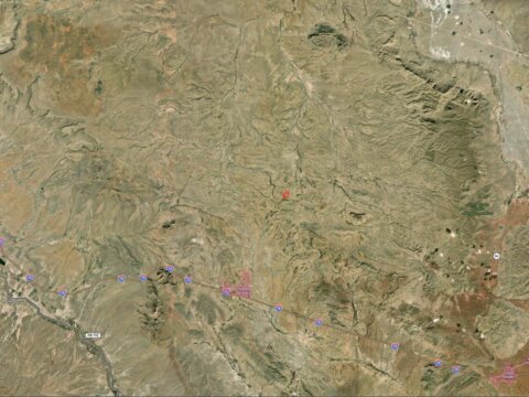
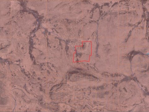
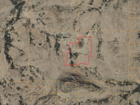
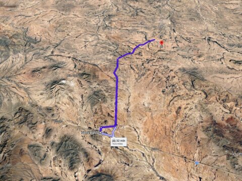
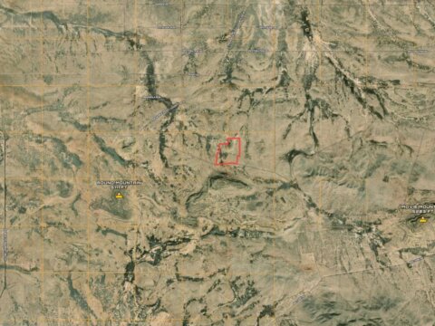
Wide-open West Texas at a scale that is getting hard to find: 140.08 contiguous acres in the Sunset Ranches area of Hudspeth County, roughly 16 miles out from Sierra Blanca and its I-10 interchange. What makes this block unusual is how it is already put together. It is seven individually surveyed 20-acre lots (Sunset Ranches Lots 8, 9, 10, 17, 18, 19 and 23) that all adjoin one another, with the corners already marked in the field with iron rods and yellow caps. Buy it as one large ranch, keep a piece and pass the rest along, or hold it as seven separate deeded lots. This is high-desert country with big sky, long horizons, and the kind of quiet you only get this far out.
PROPERTY HIGHLIGHTS:
- 140.08 total acres in Hudspeth County, Texas, made up of seven contiguous, individually surveyed 20-acre lots
- Each lot is a clean surveyed rectangle of roughly 660 feet by 1,315 feet, with the corners marked by iron rods and yellow caps
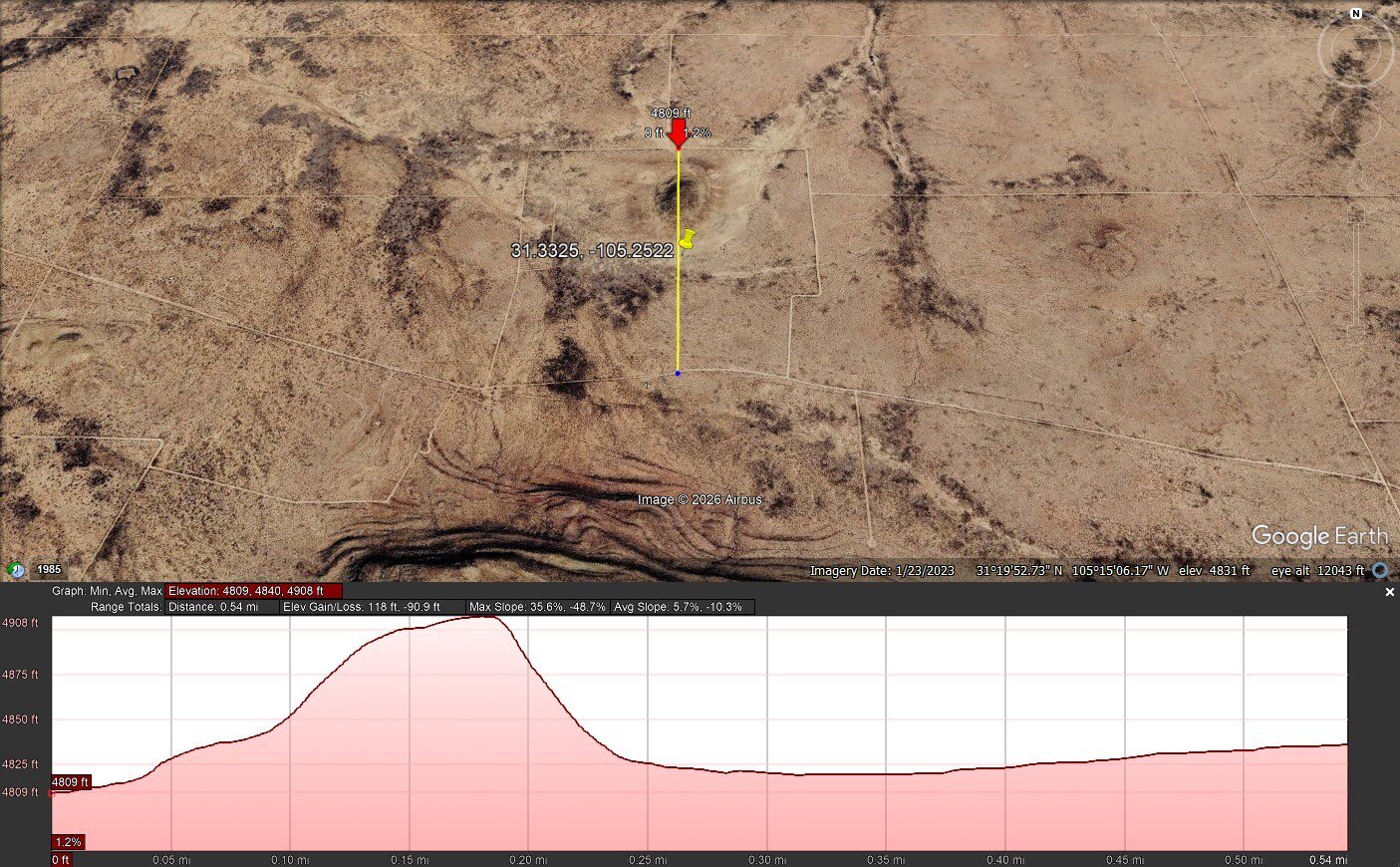
- Roughly 2,360 feet of frontage along the unpaved ranch road that runs the full length of the southern boundary, from the southwest corner to the southeast corner (frontage measured on the map; buyers should confirm legal access and road maintenance with the county)
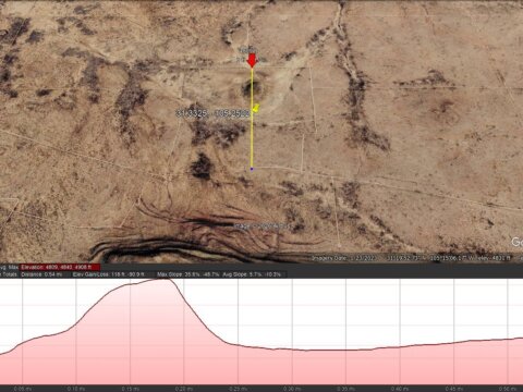
- Mostly level high-desert terrain with long views in every direction, plus a natural rise in the northern part of the block
- A creek channel crosses the northeast corner of one of the seven lots
- No zoning that we found on this parcel. Hudspeth County has no planning and zoning department, and zoning questions are handled by the County Chief Appraiser
- Our research did not turn up an HOA or association dues, though we did find restrictive covenants for the Sunset Ranches subdivision, so read through those before you plan
- Potentially subdividable into lots of at least 10 acres, subject to Hudspeth County platting requirements and its one-single-family-dwelling-per-lot density rule (buyer to verify)
- No structures and no utilities in place today. City water and sewer are roughly 16 miles away in Sierra Blanca, so plan on a well and septic
- Power service at the property is undetermined. El Paso Electric and Rio Grande Electric Cooperative serve this region, and plenty of owners out here run an off-grid solar setup instead
- Not inside any city limits; the tract sits in unincorporated county jurisdiction
- Does not adjoin public land, and the area is served by Van Horn School
- Property taxes are current
We see no reason a country homesite, cabin, or RV base camp could not work out here, but building is always subject to permits, septic approval, and the buyer’s own due diligence with Hudspeth County, so verify before you build. There is no Google Street View this far out, which tells you plenty about how remote and undisturbed it still is. If you have been looking for real acreage in West Texas, enough room to spread out, run solar, park an RV, ride, camp, shoot, stargaze, or simply own something that is genuinely yours, this 140-acre block is worth a serious look. Reach out today and we will send over the survey, the map, and everything else we know about it.
140.08 Acres – Cash Sale in Hudspeth County Texas!
Contact us Today.
Interested in this property? Call, text, or email us today for more details!
(541) 375-0012
or
Feel free to visit the property any time, no need to set up an appointment, this property has no address, the directions can be found in the google map link below.
Subscribe to email alerts by texting your e-mail address to (541) 375-0012 and be the first to know when we get a great deal in.
By texting (541) 375-0012 you authorize Country Land Group to send text messages with offers & other information, possibly using automated technology, to the number you provided. Message/data rates apply. Consent is not a condition of purchase. You may unsubscribe at any time.
Address: TBD, Frederick Rd, Sierra Blanca, TX, 79851
Cash Discount Price: $79,000
Owner Financing Terms: Unfortunately, we cannot provide owner financing on this property.
A $1,000 earnest money deposit is required to enter into a purchase agreement on this property, due at signing through our title company/attorney. The remaining balance is due in full at closing. Contact us to get started.
County: Hudspeth
Acres: 140.08 Acres (Raw Land)
Coordinates: 31.3325, -105.2522
Parcel #: 69951, 69954, 69956, 76504, 76505, 76506, and 69974
Yearly Estimated Taxes: $1,123.61
Elevation: 4,800 ft
Zoning: No Zoning
Legal Description:
APN 69974:
47 1/2 SEC 10 PSL SUNSET RANCHES UNIT #548 LOT 23 (20.01 ACRES)
APN 76506:
A 20.0109 acres parcel located in Section 9, Block 47-1/2, Public School Land, Hudspeth County, Texas, and being more particularly described by metes and bounds as follows:
COMMENCING for reference at an existing brass cap lying at NGS Tri-Station “Mesa”; THENCE, South 48°21’07” East, for basis of bearing, a distance of 34360.89 feet to an existing brass cap lying at NGS Tri-Station “Ridge”; THENCE, North 82°24’22” East, a distance of 32998.19 feet to a 5/8″ rebar with cap stamped “LAND-MARK TX4869 NM11402″ set at the common boundary corner of Section Nos. 8, 9, 12 and 13, Block 47-1/2, Public School Land; THENCE, South 89°57’57” East, with the common boundary line of said Section Nos. 9 and 12, a distance of 5269.63 feet to a 5/8″ rebar with cap stamped “LAND-MARK TX4869 NM11402″ set at the common boundary corner of Section Nos. 9, 10, 11 and 12, Block 47-1/2, Public School Land; THENCE, North 00°00’50” West, with the common boundary line of said Section Nos. 9 and 10, a distance of 1769.57 feet to a point for a corner and the POINT OF BEGINNING of this parcel description;
THENCE, South 83°51’10” West, a distance of 230.10 feet to a point for a corner of this parcel;
THENCE, South 84°49’56” West, a distance of 425.16 feet to a point for a corner of this parcel;
THENCE, North 01°17’24” East, at a distance of 30.19 feet pass a set 5/8″ rebar with cap stamped “LAND-MARK TX4869 NM11402″ and continuing for a total distance of 1351.07 feet to a 5/8” rebar with cap stamped “LAND-MARK TX4869 NM11402”, set for a corner of this parcel;
THENCE, North 80°50’18” East, a distance of 629.49 feet to a 5/8″ rebar with cap stamped “LAND-MARK TX4869 NM11402”, set in the common boundary line of said Section Nos. 9 and 10, for a corner of this parcel;
THENCE, South 00°00’50” East, with said common boundary line, at a distance of 1357.64 feet pass a set 5/8″ rebar with cap stamped “LAND-MARK TX4869 NM11402” and continuing for a total distance of 1388.02 feet to the TRUE POINT OF BEGINNING.
Said Parcel contains 20.0109 acres (871,673 square feet) more or less.
APN 76505:
A 20.0246 acres parcel located in Section 9, Block 47-1/2, Public School Land, Hudspeth County, Texas, and being more particularly described by metes and bounds as follows:
COMMENCING for reference at an existing brass cap lying at NGS Tri-Station “Mesa”; THENCE, South 48°21’07” East, for basis of bearing, a distance of 34360.89 feet to an existing brass cap lying at NGS Tri-Station “Ridge”; THENCE, North 82°24’22” East, a distance of 32998.19 feet to a 5/8″ rebar with cap stamped “LAND-MARK TX4869 NM11402″ set at the common boundary corner of Section Nos. 8, 9, 12 and 13, Block 47-1/2, Public School Land; THENCE, South 89°57’57” East, with the common boundary line of said Section Nos. 9 and 12, a distance of 5269.63 feet to a 5/8″ rebar with cap stamped “LAND-MARK TX4869 NM11402″ set at the common boundary corner of Section Nos. 9, 10, 11 and 12, Block 47-1/2, Public School Land; THENCE, North 00°00’50” West, with the common boundary line of said Section Nos. 9 and 10, a distance of 3157.59 feet to a point; THENCE, South 80°50’18” West, a distance of 629.49 feet to a 5/8″ rebar with cap stamped “LAND-MARK TX4869 NM11402”, set for a corner and the POINT OF BEGINNING of this parcel description;
THENCE, South 01°17’24” West, at a distance of 1320.88 feet pass a set 5/8″ rebar with cap stamped “LAND-MARK TX4869 NM11402” and continuing for a total distance of 1351.07 feet to a point for a corner of this parcel;
THENCE, South 84°42’47” West, a distance of 433.19 feet to a point for a corner of this parcel;
THENCE, South 82°41’08” West, a distance of 275.81 feet to a point for a corner of this parcel;
THENCE, North 05°20’38” East, a distance of 1332.98 feet to a point for a corner of this parcel;
THENCE, North 80°50’18” East, a distance of 619.08 feet to the TRUE POINT OF BEGINNING.
Said Parcel contains 20.0246 acres (872,272 square feet) more or less.
APN 76504:
A 20.0116 acres parcel located in Section 9, Block 47-1/2, Public School Land, Hudspeth County, Texas, and being more particularly described by metes and bounds as follows:
COMMENCING for reference at an existing brass cap lying at NGS Tri-Station “Mesa”; THENCE, South 48°21’07” East, for basis of bearing, a distance of 34360.89 feet to an existing brass cap lying at NGS Tri-Station “Ridge”; THENCE, North 82°24’22” East, a distance of 32998.19 feet to a 5/8″ rebar with cap stamped “LAND-MARK TX4869 NM11402″ set at the common boundary corner of Section Nos. 8, 9, 12 and 13, Block 47-1/2, Public School Land; THENCE, South 89°57’57” East, with the common boundary line of said Section Nos. 9 and 12, a distance of 5269.63 feet to a 5/8″ rebar with cap stamped “LAND-MARK TX4869 NM11402″ set at the common boundary corner of Section Nos. 9, 10, 11 and 12, Block 47-1/2, Public School Land; THENCE, North 00°00’50” West, with the common boundary line of said Section Nos. 9 and 10, a distance of 3157.59 feet to a 5/8″ rebar with cap stamped “LAND-MARK TX4869 NM11402”, set for a corner and the POINT OF BEGINNING of this parcel description;
THENCE, South 80°50’18” West, at a distance of 952.68 feet pass a set 5/8″ rebar with cap stamped “LAND-MARK TX4869 NM11402” and continuing for a total distance of 982.88 feet to a point for a corner of this parcel;
THENCE, North 02°32’50” West, a distance of 957.31 feet to a point for a corner of this parcel;
THENCE, South 89°55’45” East, at a distance of 30.03 feet pass a set 5/8″ rebar with cap stamped “LAND-MARK TX4869 NM11402″ and continuing for a total distance of 1012.70 feet to a 5/8” rebar with cap stamped “LAND-MARK TX4869 NM11402”, set in common boundary line of said Section Nos. 9 and 10, for a corner of this parcel;
THENCE, South 00°00’50” East, with said common boundary line, a distance of 798.61 feet to the TRUE POINT OF BEGINNING.
Said Parcel contains 20.0116 acres (871,706 square feet) more or less.
APN 69956:
A 20.0079 acre parcel located in Section No. 10, Block 47-1/2, Public School Land, Hudspeth County, Texas, and being more particularly described by metes and bounds as follows:
COMMENCING for reference at an existing brass cap lying at NGS Tri-Station “Mesa”; THENCE, South 48°21’07” East, for basis of bearing, a distance of 34360.89 feet to an existing brass cap lying at NGS Tri-Station “Ridge”; THENCE, North 83°27’17” East, a distance of 38227.59 feet to a 5/8″ rebar with cap stamped “LAND-MARK TX4869 NM11402″ set at the common boundary corner of Section Nos. 9, 10, 11 and 12, Block 47-1/2, Public School Land; THENCE, North 00°00’50” West, with the common boundary line of said Section Nos. 9 and 10, a distance of 2630.79 feet to a 5/8″ rebar with cap stamped “LAND-MARK TX4869 NM11402”, set for a corner and the POINT OF BEGINNING of this parcel description;
THENCE, North 00°00’50” West, continuing with said common boundary line, a distance of 662.71 feet to a 5/8″ rebar with cap stamped “LAND-MARK TX4869 NM11402”, set for a corner of this parcel;
THENCE, North 89°59’39” East, at a distance of 1285.66 feet pass a set 5/8″ rebar with cap stamped “LAND-MARK TX4869 NM11402” and continuing for a total distance of 1315.66 feet to a point for a corner of this parcel;
THENCE, South 00°09’47” East, a distance of 661.31 feet to a point for a corner of this parcel;
THENCE, South 89°56’00” West, a distance of 1317.38 feet to the TRUE POINT OF BEGINNING.
Said Parcel contains 20.0079 acres (871,546 square feet) more or less.
APN 69954:
A 20.0080 acre parcel located in Section No. 10, Block 47-1/2, Public School Land, Hudspeth County, Texas, and being more particularly described by metes and bounds as follows:
COMMENCING for reference at an existing brass cap lying at NGS Tri-Station “Mesa”; THENCE, South 48°21’07” East, for basis of bearing, a distance of 34360.89 feet to an existing brass cap lying at NGS Tri-Station “Ridge”; THENCE, North 83°27’17” East, a distance of 38227.59 feet to a 5/8″ rebar with cap stamped “LAND-MARK TX4869 NM11402″ set at the common boundary corner of Section Nos. 9, 10, 11 and 12, Block 47-1/2, Public School Land; THENCE, North 00°00’50” West, with the common boundary line of said Section Nos. 9 and 10, a distance of 3293.50 feet to a 5/8″ rebar with cap stamped “LAND-MARK TX4869 NM11402”, set for a corner and the POINT OF BEGINNING of this parcel description;
THENCE, North 00°00’50” West, continuing with said common boundary line, a distance of 662.71 feet to a 5/8″ rebar with cap stamped “LAND-MARK TX4869 NM11402”, set for a corner of this parcel;
THENCE, North 89°58’45” East, at a distance of 1283.93 feet pass a set 5/8″ rebar with cap stamped “LAND-MARK TX4869 NM11402” and continuing for a total distance of 1313.93 feet to a point for a corner of this parcel;
THENCE, South 00°09’47” East, a distance of 663.05 feet to a point for a corner of this parcel;
THENCE, South 89°59’39” West, at a distance of 30.00 feet pass a set 5/8″ rebar with cap stamped “LAND-MARK TX4869 NM11402” and continuing for a total distance of 1315.66 feet to the TRUE POINT OF BEGINNING.
Said Parcel contains 20.0080 acres (871,547 square feet) more or less.
APN 69951:
A 20.0080 acre parcel located in Section No. 10, Block 47-1/2, Public School Land, Hudspeth County, Texas, and being more particularly described by metes and bounds as follows:
COMMENCING for reference at an existing brass cap lying at NGS Tri-Station “Mesa”; THENCE, South 48°21’07” East, for basis of bearing, a distance of 34360.89 feet to an existing brass cap lying at NGS Tri-Station “Ridge”; THENCE, North 83°27’17” East, a distance of 38227.59 feet to a 5/8″ rebar with cap stamped “LAND-MARK TX4869 NM11402″ set at the common boundary corner of Section Nos. 9, 10, 11 and 12, Block 47-1/2, Public School Land; THENCE, North 00°00’50” West, with the common boundary line of said Section Nos. 9 and 10, a distance of 3956.20 feet to a point for a corner and the POINT OF BEGINNING of this parcel description;
THENCE, North 00°00’50” West, continuing with said common boundary line, at a distance of 632.72 feet pass a set 5/8″ rebar with cap stamped “LAND-MARK TX4869 NM11402” and continuing for a total distance of 662.72 feet to a point for a corner of this parcel;
THENCE, North 89°57’53” East, a distance of 1315.64 feet to a point for a corner of this parcel;
THENCE, South 00°08’02” West, a distance of 663.05 feet to a point for a corner of this parcel;
THENCE, South 89°58’45” West, at a distance of 30.00 feet pass a set 5/8″ rebar with cap stamped “LAND-MARK TX4869 NM11402” and continuing for a total distance of 1313.93 feet to the TRUE POINT OF BEGINNING.
Said Parcel contains 20.0080 acres (871,547 square feet) more or less.
If this property is not what you are looking for, go to our website at www.countrylandsellers.com and sign up for our deal alerts; you will be notified whenever we have a new property for sale! Or, e-mail, call or text us, and we may be able to find the property you are looking for.
Disclaimers: This property is being sold “as is”. We do our best to collect accurate information, but we cannot guarantee that any of the information in this ad is correct, we recommend each buyer do their own research. We do our best to get pictures of the actual property, but they may not be of the property we are advertising. This Property is being sold “as is”, the information we have listed in this ad may or may not be correct, but it is what we found when we researched this property. Please talk to a surveyor if you wish to verify the size of the property, the property may not be the size we have listed in the ad, we are just relaying the information the county has on the property. Under no circumstances do we ever do refunds on any property, it is the buyers responsibility to do their own due diligence before buying.
Property ID: TX-Hudspeth-140.08-BE-2026-Joint